Murphy Geological Services
  • Home
  • About
  • Satellite Image Interpretation
  • New - Sentinel-2
  • Field structural analysis
  • Satellite Image Processing
  • Project example
  • Worldwide Project Coverage
  • Projects
  • Clients
  • Experience
  • Contact Us
  • Blog
  • Home
  • About
  • Satellite Image Interpretation
  • New - Sentinel-2
  • Field structural analysis
  • Satellite Image Processing
  • Project example
  • Worldwide Project Coverage
  • Projects
  • Clients
  • Experience
  • Contact Us
  • Blog

Satellite image Interpretation

Picture
Murphy Geological Services (MGS) provide a premium satellite image interpretation service to the mineral exploration and mining industry at very reasonable costs.

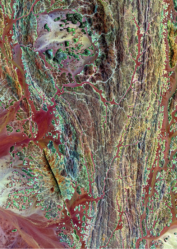
A sound understanding of the structural controls on mineralization is vital for successful mineral exploration. Geological structures can play an important part in ground preparation, in controlling hydrothermal fluid flow, localization of a mineral deposit and the subsequent deformation of a deposit. A prerequisite for any exploration programme should be the acquisition and interpretation of satellite imagery in order to define the structural setting of a mine or prospect using data such as Sentinel-2, Landsat ETM+ and ASTER imagery. More detailed analysis of mines and prospects can be undertake using high resolution data such as Pleiades, GeoEye-1 or WorldView satellite imagery or aerial/drone imagery.

For a quote please contact Dr. Francis Murphy:
frxmurphy@gmail.com


Picture

Dr. Francis Murphy has been undertaking consultancy projects involving the interpretation of satellite imagery for mineral and petroleum exploration since 1990. In 2002 he established his own consultancy business (Murphy Geological Services) with the aim of providing a high quality, value for money satellite image interpretation/structural analysis service to the mineral exploration industry.
Picture
Picture

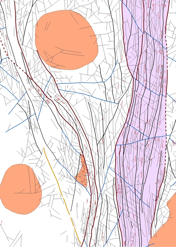
A typical image interpretation project involves the identification of:
  • Regional structures;
  • Major faults/shear zones;
  • Second order faults, shears and fracture zones;
  • Major folds;
  • Linear resistant features/dykes/broad veins;
  • Domal/circular features;
  • Broad circular structures/caldera rims;
  • Radial and concentric fault sets;
  • Distinctive lithological units.
A data synthesis is then undertaken involving:
  • Using the image interpretation, existing geological maps, geochemical and geophysical data supplied by the client in order to define the structural framework of the study area;
  • Identification of the principal structural corridors from the imagery and geophysics data and correlation with known major fault systems;
Picture

  • Structural modeling to estimate fault zone kinematics, and identify dilational areas (releasing bends, jogs, fault intersections, relay zones between overlapping faults, breached relay zones), contractional areas (restraining bends, jogs, converging faults), areas of enhanced fracture permeability and fluid pathways;
  • Correlation between interpreted structure, linear resistant features, domal/circular features and Sentinel-2, Landsat and/or ASTER derived alteration anomalies;
  • The structural framework and alteration data are used to generate exploration target areas;
  • Production of detailed report on image processing, interpretation methodology, results and discussion of target area with high quality maps and diagrams.
Picture
Picture
Picture
Picture
For most of our projects we acquire satellite imagery from the suppliers (USGS, Digital Globe etc.) and process the data. However, if a client has previously obtained imagery we will be happy to use that for interpretation.
  • Has your company acquired satellite imagery which you feel has not been utilized to the full?
  • Have you been provided with an interpretation that was merely a lineament analysis which has not established the structural framework of the area?
  • If so we will be happy to take your imagery, produce a high quality interpretation and generate new exploration targets enabling you to obtain the maximum value from the data.

Picture
Murphy Geological Services - Structural analysis of satellite imagery and structural field analysis for Mineral Exploration. 
Site powered by Weebly. Managed by Letshost.ie