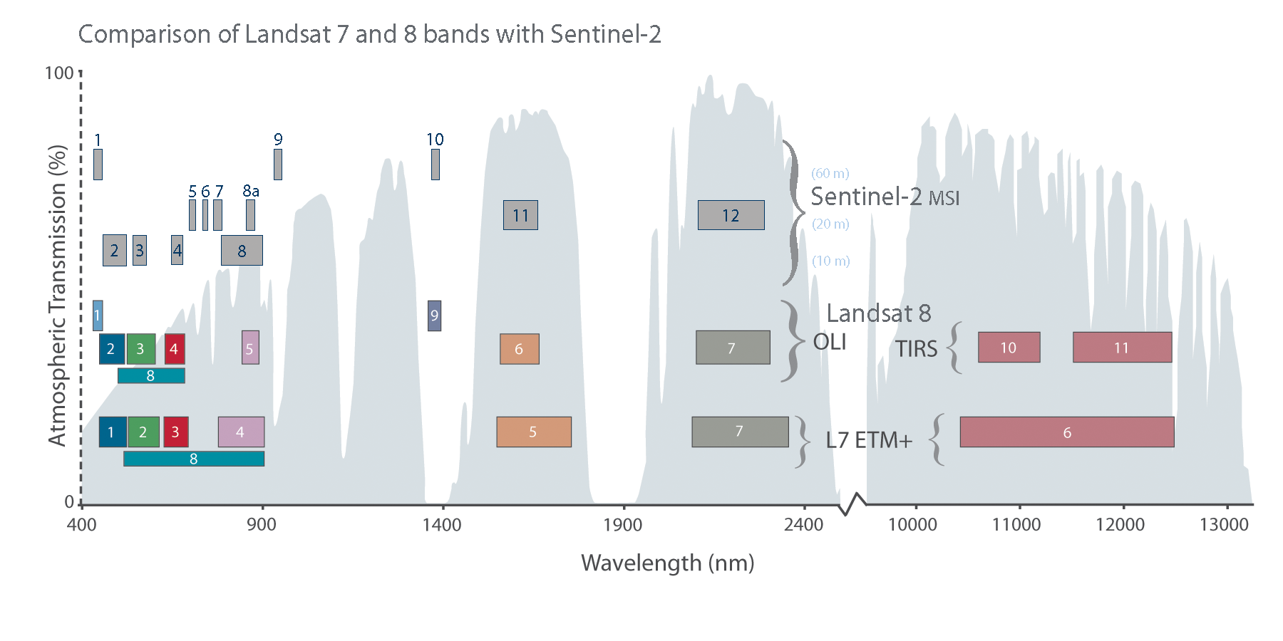
Sentinel-2 is a new earth observation sensor launched by the European Space Agency in June 2015 and heralds a new era in regional/ district to prospect scale analysis. The Sentinel-2 satellite carries a wide swath, high-resolution multispectral imager with 13 spectral bands. It has a 290 km swath width and a rapid revisit time (5 days at the Equator). It contains four 10 m resolution bands and six 20 m resolution bands as well as three 60 m resolution bands. The 10 m data represents a substantial increase in resolution compared to pan-sharpened 15 m resolution Landsat 7, Landsat 8 and ASTER data. The resolution is more than doubled. For example, a block of 100 square meters is represented by 100 pixels on a Sentinel-2 image but only approximately 45 pixels on pan-sharpened Landsat and ASTER imagery. Consequently the Sentinel-2 imagery can be used for very detailed analysis which was previously only possible by obtaining expensive very high resolution imagery. Due to the rapid revisit time the Sentinel-2 archives have expanded substantially since the data first became available in late 2015. Due to the large data volume the Sentinel-2 data is provided in 100 km (E-W) by 100 km (N-S) tiles rather than by scene. The unprocessed data is available FREE of charge. We can provide high quality processed imagery and detailed interpretations.
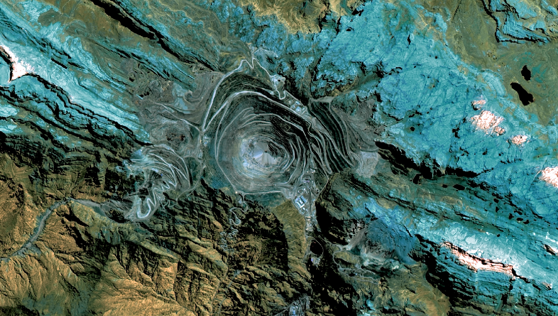
Grasberg open pit on Sentinel-2
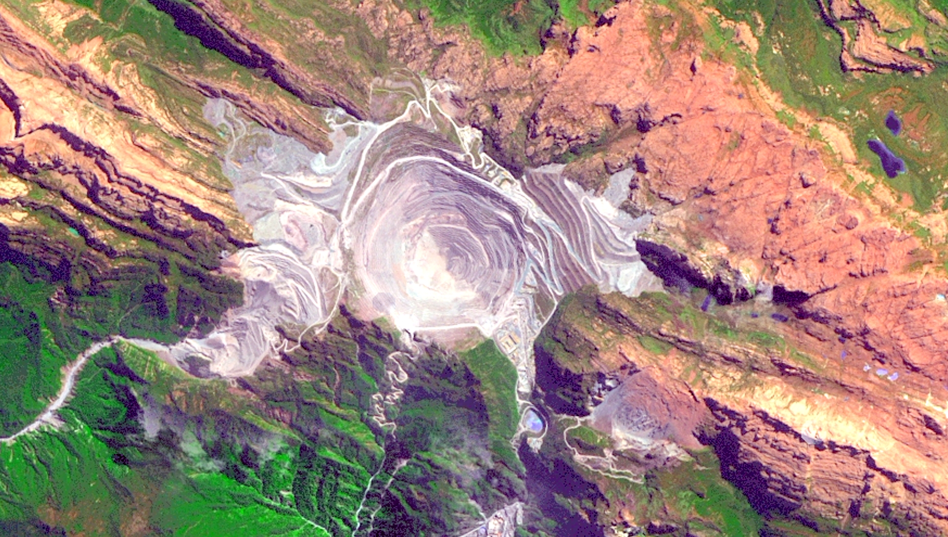
Grasberg open pit on Landsat 8
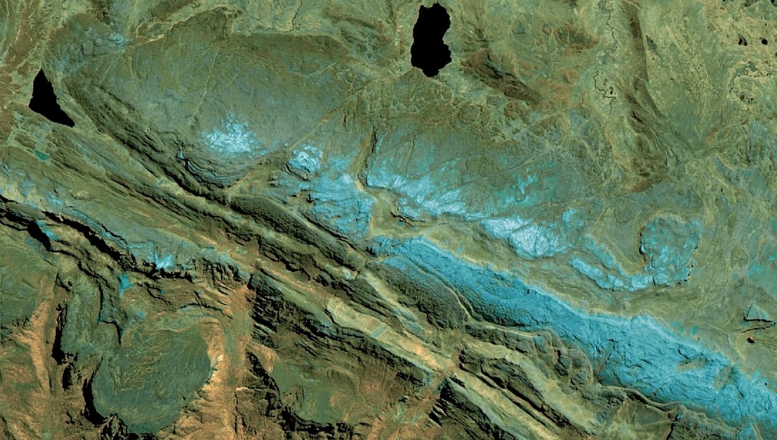
Part of Papuan fold and thrust belt on Sentinel-2 image, 8-11-12 band combination
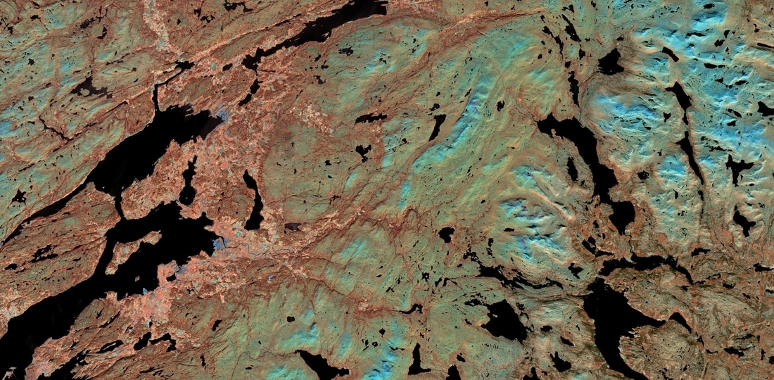
Central Norway, Sentinel 8-11-12 band combination
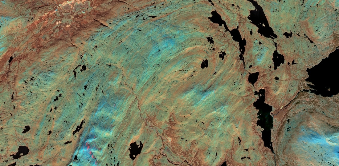
Fold, Central Norway on Sentinel 8-11-12 band combination
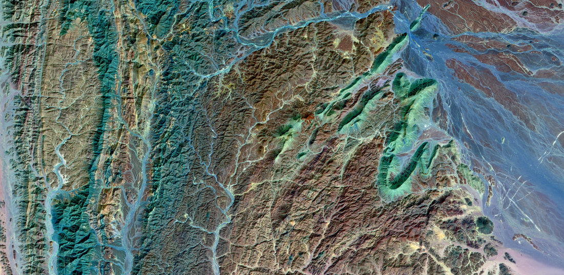
Folded metasediments, northeast Sudan on Sentinel 12-8-2 band combination
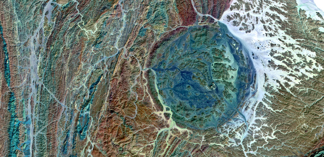
Subcircular granitoid intrusion to east of major shear zone, northeast Sudan on Sentinel 12-8-2 band combination
Enlarged view of subcircular granitoid intrusion, northeast Sudan on Sentinel 12-8-2 band combination
Part of North Anatolian Fault Zone, northeast Turkey on Sentinel 12-8-3 band combination