

|
|
InterpretationThe ASTER 8-3N-1 image (see image above) has a resolution of 15 m per pixel and is the optimal band combination for structural and lithological interpretation. The area is composed of Tertiary volcanics, volcaniclastics and sediments. An elongate granite intrusion occurs in the west/northwest and tapers out southwards (see interpretation map to the right). Gold bearing low sulphidation epithermal quartz veins are known to occur in the district.
The structural framework of the area is dominated by a linked fault system consisting of laterally continuous NNE/NE trending major faults in the north and south and a central zone of NNW/N-S trending major faults. Several vein swarms have been identified. Most are associated with subparallel major or minor faults and veins are commonly located along the surface traces of faults. |

|
|
|

|
Major faults and circular features are superimposed on the ASTER 8-3N-1 image on the left
|

A northward diverging quartz vein system is visible on the ASTER image above. The veins are localized along a NNW-SSE trending major fault which forms the western bounding structure to a small pull-apart zone (see below).
|

The above diagram shows the ASTER interpretation for the district in the vicinity of the northward diverging vein swarm. Broader quartz bodies have also been identified indicating that the zone was highly dilational and has been subject to quartz floodings as well as multiple episodes of vein formation. Another less well developed vein system is associated with the NNW/N-S trending major faults that form the eastern bounding structure to the pull-apart zone in the northeast of this image extract.
|

|
Alteration processing
The ASTER data was processed for alunite-dickite-kaolinite-pyrophyllite-sericite assemblages. The image to the left shows the alunite alteration intensities. It is evident that there are a number of high temperature alteration centres in the area and many of these appear to be localized along structures indicating that there is a strong structural control on hydrothermal fluid migration and alteration
|
|
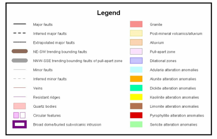
The major structures and a range of alteration anomalies are shown in the diagram to the right (see legend above for key to alteration colour coding). A number of areas of extensive hydrothermal alteration have been identified. In particular a broad area of alteration is located in the north-central part of the area just on the northern margin of the pull-apart zone. Three small circular/domal features have also been identified in this area and may be related to intrusive stocks or small subvolcanic intrusions.
Extensive alteration is also developed in the southeast corner of the pull-apart zone. Some of these anomalies appear to lie along the periphery of a broad circular/domal feature and along structures that extend northwards from the subvolcanic intrusion thought to be responsible for the updoming in this area. Strongly developed alteration anomalies are also present along the southern part of the bounding structure on the western side of the pull-apart zone. This area also coincides with the western margin of the broad circular/domal feature. |

|

The large circular/domal feature in the south is centered on the southern margin of the pull-apart zone. The intersections between the southern NNE/NE trending fault and the NNW/N-S trending faults on the eastern and western margins of the pull-apart zone may have controlled the emplacement of a subvolcanic intrusion since these are likely to be deeply penetrating structures. The intrusion is considered to have been the source of the hydrothermal and mineralizing fluids which migrated outwards along the bounding faults of the pull-apart zone and along other structures to the east and south. It is also possible that the subvolcanic intrusion could be a buried porphyry with potential for copper porphyry mineralization. A number of epithermal gold and copper porphyry exploration targets were generated using the structural synthesis and alteration anomaly data. The client was then able to focus their exploration program on the most prospective zones saving them a considerable amount of time and expense. |
A pull-apart zone has been generated in the overlap zone between two district scale NNE/NE trending faults. Further propagation of the northern fault was inhibited by the elongate granite in the west which acted as a rigid resistant block. Sinistral strike-slip movement along this structure during the syn-mineral extensional/transtension stress regime was transferred to the overlapping NNE/NE trending structure to the south. The intervening area represents a dilational area where a pull-apart zone was generated, bounded by NNE/NE faults to the north and south and by NNW/N-S trending major faults to the east and west. The displacement across the eastern and western bounding structures was not large enough to form a true pull-apart basin, but was enough to produce significant dilation and open up these faults to hydrothermal fluid flow resulting in alteration and the generation of quartz veins.
Vein swarms are commonly located in dilational zones related to releasing bends along other major faults in the study area. It is likely that many of the vein systems are partially buried beneath post-mineral volcanics and sediments and such areas represent blind exploration targets. |
