
|
2012-2025
R/25-01 Structural interpretation of Sentinel-2 and Landsat satellite imagery for the Chagai Hills, Balochistan, Pakistan R/25-02 Structural interpretation of Sentinel-2 satellite imagery for the Estelle project, south-central Alaska, U.S.A. R/25-03 Structural interpretation of Sentinel-2 satellite imagery for the Idenburg project, northeast Papua, Indonesia. R/25-04 Structural interpretation of Sentinel-2 and Landsat satellite imagery for noprth-central Zambia. In Progress. R/24-01 Structural interpretation of Sentinel-2 satellite imagery for the Toka Tindung project area, North Sulawesi, Indonesia. R/24-02 Structural field analysis of Los Azules project area, San Juan Province, Argentina. R/24-03 Structural interpretation of Sentinel-2 satellite imagery for the Kapuas project area, Central Kalimantan, Indonesia. R/24-04 Structural interpretation of Landsat & Sentinel-2 satellite imagery for northeastern DRC/north-central Zambia - Phase 1. R/24-05 Structural interpretation of Landsat & Sentinel-2 satellite imagery for northeastern DRC/north-central Zambia - Phase 2. R/24-06 Structural interpretation of Sentinel-2 satellite imagery for CLM project , central Laos. R/24-07 Structural interpretation of Sentinel-2 satellite imagery for the Sulitjelma project, northern Norway. R/24-08 Structural interpretation of Sentinel-2 satellite imagery for Oko project, Red Sea State, northeastern Sudan. R/23-01 Structural interpretation of Sentinel-2 satellite imagery for the Baie Verte Target, Newfoundland, Canada. R/23-02 Structural interpretation of Sentinel-2, ASTER and Pleiades satellite imagery for the Chambarak project area, northeastern Armenia. R/23-03 Structural analysis of the Creenhill prospect, Northern Ireland. R/23-04 Structural interpretation of Sentinel-2, ASTER and WorldView-2 satellite imagery for the Karaberd project area, northeastern Armenia. R/23-05 Structural field analysis of the Simms Ridge project area, Newfoundland, Canada. R/23-06 Processing of Sentinel-2 and DEM data for the Koskol project area, Aktobe Province, Kazakhstan. R/23-07 Structural interpretation of Sentinel-2 imagery for Lithium exploration in the Leinster District, Ireland. R/23-08 Structural and exploration summary map of the CC-KK Zone, Montezuma project, Zimbabwe. R/23-09 Structural interpretation of Sentinel-2 and ASTER satellite imagery for the Aramo Co-Cu-Ni project, Asturias, northern Spain. R/23-10 Structural interpretation of Sentinel-2 satellite imagery for the Trenggalek project area, East Java, Indonesia. R/22-01 Structural interpretation of Sentinel-2 and aeromagnetic data for the Moribala Permit, southwestern Mali. R/22-02 Structural interpretation of Sentinel-2 and WorldView-2 imagery for the Block RS69 project area, Red Sea State, northeastern Sudan. R/22-03 Structural interpretation of Sentinel-2 imagery and aeromagnetic data for the Morila project area, southwestern Mali. R/22-04 Structural interpretation of Sentinel-2 imagery for the Oweegee Dome project area, northwestern British Columbia, Canada. R/22-05 Structural interpretation of Sentinel-2 imagery for Wetar and Romang Islands, Maluku Province, Indonesia. R/22-06 Structural interpretation of Sentinel-2 imagery for West Timor, East Nusa Tenggara Province, Indonesia. R/22-07 Structural interpretation of Sentinel-2 imagery for East Timor. R/22-08 Structural interpretation of Sentinel-2 and Pleiades satellite imagery for the Schreiber-Hemlo project area, Ontario, Canada. R/22-09 Structural interpretation of Sentinel-2 and WorldView satellite imagery for Los Azules project, San Juan Province, Argentina. R/22-10 Structural interpretation of Sentinel-2 and WorldView-2 satellite imagery for the Simms Ridge project area, Newfoundland, Canada. R/21-01 Interpretation of orthophoto mosaics for the Montezuma Licence, southern Zimbabwe. R/21-02 Structural interpretation of Sentinel-2 and WorldView-3 imagery for the Frostmoen project area, Nordland, northern Norway. R/21-03 Structural interpretation of Sentinel-2 and Pleiades imagery for the Flintfjellet project area, Finnmark, northern Norway. R/21-04 Structural interpretation of Sentinel-2 imagery for the Jebilte-Guemassa project area, west-central Morocco: Final Report. R/21-05 Review of grades and tonnage for the CC-KK Zone, Montezuma project, southern Zimbabwe. R/21-06 Structural interpretation of an area centered on Alba Mineral Resources' Prospecting Licence (PL 3824) in Co. Limerick, Ireland. R/21-07 Structural interpretation of Sentinel-2 imagery and geophysical data for the Igkila project area, East Srednogoria Zone, Bulgaria. R/21-08 Structural interpretation of Sentinel-2 imagery for the TAIWA Project, East Halmahera, Indonesia. R/21-09 Structural interpretation of WorldView-2 imagery for the DGL16 claims, southern Zimbabwe. R/21-10 Structural interpretation of Sentinel-2 imagery for West Kalimantan, Indonesia. R21-11 Structural interpretation of Sentinel-2 and Hi-Res imagery for the Sangihe Project, Sangihe Island, North Sulawesi Province, Indonesia. R/20-01 Structural interpretation of Sentinel-2 imagery for VMS mineralization in the Jebilte-Guemassa District, west-central Morocco. R/20-02 Structural interpretation of Landsat ETM+ imagery for the Exporien claim areas, Shurugwi District, central Zimbabwe. R/20-03 Structural interpretation of satellite imagery for the Deseado Massif, Santa Cruz Province, Argentina. R/20-04 Provision of WorldView-2 and Kompsat-3 imagery for the Asenko project area, southern Ghana. R/20-05 Interpretation of Sentinel-2 and Landsat imagery for areas in northern Peru. R/20-06 Interpretation of Sentinel-2 imagery for WUSA project area, southern Oregon, U.S.A. In progress. R/19-01 Field structural analysis of the Abisha Region, Papua, Indonesia. R/19-02 Structural interpretation of Sentinel-2 and ASTER imagery for the Lawless Creek Creek project area, south-central British Columbia, Canada. R/19-03 Structural analysis of the Lisglassan stream section, Co. Monaghan, Ireland. R/19-04 Structural interpretation of Sentinel-2 satellite imagery for the Sepola project area, western Mali. R/19-05 Review of the structural controls on the Clontibret Gold Deposit, Co. Monaghan, Ireland. R/19-06 Structural interpretation of Sentinel-2 imagery and aeromagnetic data imagery for the Sakiatieva project area, northern Finland. R/19-07 Structural interpretation of Sentinel-2 imagery for Area A in the Central Norwegian VMS District R/19-08 Structural interpretation of Sentinel-2 and ASTER imagery for the Bougouni project area, southwestern Mali. R/19-09 Structural interpretation of Sentinel-2 imagery and orthophotos for the Tuscarora project area, northeastern Nevada, U.S.A. R/19-10 Structural interpretation of Sentinel-2 and WorldView imagery for the Cordero project area, south-central Chihuahua, Mexico. R/18-01 Structural interpretation of Sentinel-2 imagery for the West Africa Framework Project. R/18-02 Structural study of an area centered on Group Eleven's Prospecting Licences in Co. Limerick, Ireland. R/18-03 Structural study of an area centered on Group Eleven's Prospecting Licences in the Silvermines-Ferbane District, Co. Tipperary, Ireland. R/18-04 Structural interpretation of Sentinel-2 imagery for the Sikasso Project, southwestern Mali. R/18-05 Structural interpretation of Sentinel-2 and Landsat 7 imagery for the Abisha Region, Papua, Indonesia. R/18-06 Structural interpretation of Sentinel-2 imagery for the Santander District, west-central Peru. R/18-07 Structural interpretation of Sentinel-2 imagery for the Perkoa District, west-central Burkina Faso. R/18-08 Structural interpretation of Sentinel-2 imagery for the Rosh Pinah project area, southwestern Namibia. R/18-09 Structural interpretation of satellite imagery for the northern part of the Kechika Trough, north-central British Columbia, Canada. R/18-10 Structural interpretation of Sentinel-2 and Landsat 7 imagery for the McConnell Creek Project, north-central British Columbia, Canada. R/17-01 Structural interpretation of Landsat and Sentinel-2 satellite imagery for the Nabire project area, Papua, Indonesia. R/17-02 Structural interpretation of GeoEye-1 imagery for the Montezuma Claim area, Zimbabwe. R/17-03 Structural interpretation of Landsat 7, Sentinel-2 and Pleiades-1A satellite imagery for Kechika Trough Project, north-central British Columbia, Canada. R/17-04 Processing of Sentinel-2 imagery (27 tiles) for the Central VMS Province, Norway. R/17-05 Structural interpretation of Sentinel-2 and ASTER imagery for the Golcuk Licence, Silvas Province, northeast Turkey. R/17-06 Structural study using Sentinel-2 imagery for an area centered on the Lismore and Fermoy Propsecting Licences, Counties Waterford and Cork, Ireland. R/17-07 Structural interpretation of Sentinel-2 imagery for Licence 5B, northeast Sudan. R/17-08 Prospectivity of Target M-23 in the Montezuma Licence, southern Zimbabwe. R/17-09 Structural interpretation of Sentinel-2 and ASTER imagery for Block 17C, north-central Sudan. R/17-10 Structural interpretation of Sentinel-2 and ASTER imagery for the Horzum Project area, Adana Province, south-central Turkey. R/17-11 Structural interpretation of Sentinel-2 imagery for the Sukari Project area, Central Eastern Desert, Egypt. R/17-12 Structural interpretation of Sentinel-2 and Landsat 7 imagery for the Termon Block, County Donegal, Ireland. R/16-01 Structural interpretation of satellite imagery for North Arm of Sulawesi: Preliminary Report. R/16-02 Field visit to Andi and Orotierra Concessions, southeast Ecuador. R/16-03 Field visit to El Corazon Mine, Imbabura Province, northern Ecuador. R/16-04 Structural interpretation of satellite imagery for North Arm of Sulawesi: Final Report. R/16-05 Structural interpretation of satellite imagery for Seruyung Region, North Kalimantan, Indonesia. R/16-06 Structural analysis of the Clontibret Stream Section, Co. Monaghan, Ireland. R/16-07 Structural study of an area centered on Adventus Exploration's Rathkeale Prospecting Licences, Co. Limerick, Ireland. R/16-08 Acquisition and processing of WorldView-2 imagery for the Anumso project area, Ashanti Region, Ghana. R/16-09 Acquisition and processing of Pleiades imagery for the Kossanto project area, southwestern Mali. R/16-10 Structural interpretation of Landsat and Sentinel-2 satellite imagery for the Mimika project area, Papua, Indonesia. R/15-01 Structural interpretation of satellite and aerial imagery for the Excelsior and Warrior project area, southwestern Nevada, USA. R/15-02 Structural interpretation of ASTER and Landsat 8 imagery for the Black Angel project area, Maarmorilik, western Greenland. R/15-03 Discussion of high priority targets for the Excelsior and Warrior project area, southwestern Nevada, USA. R/15-04 Structural interpretation of satellite and aerial imagery for the New Pass project area, central Nevada, USA. R/15-05 Structural interpretation of satellite imagery for central Malaysia R/15-06 Structural interpretation of Landsat TM mosaic for Government Reservation Area II, east-central Lao PDR. R/15-07 Structural interpretation of Landsat TM mosaic for Government Reservation Area V, northwestern Lao PDR. R/15-08 Structural interpretation of Landsat TM mosaic for Government Reservation Area VIII, southeast Lao PDR. R/15-09 Structural interpretation of Landsat TM mosaic for Government Reservation Area X, southern Lao PDR. R/15-10 Structural interpretation of Landsat TM mosaic for Government Reservation Area VI, north-central Lao PDR. R/15-11 Structural interpretation of Landsat TM mosaic for Government Reservation Area III, north-central Lao PDR. R/15-12 Structural interpretation of Landsat TM mosaic for Government Reservation Area II, III, V, VI, VIII and X Lao PDR. R/15-13 Review of exploration targets for the Attapeu project area, southeastern Lao PDR. R/15-14 Field structural analysis of selected target areas in the Central Gold Belt, Malaysia. R/15-15 Interpretation of Landsat ETM+ imagery for the Orotierra and Andi Concessions and surrounding district, Southeast Ecuador. R/14-01 Interpretation of WorldView-2 imagery for the Galat Sufur South project area, Block 14, northeast Sudan. R/14-02 Structural interpretation of Landsat ETM+ and ASTER imagery for the Gunnison project area, southwest Colorado, USA. R/14-03 Interpretation of re-processed magnetic data for Galat Sufur South, Block 14, northeast Sudan. R/14-04 Structural interpretation of RapidEye imagery and geophysical data for the Conroy PLs, Counties Cavan and Monaghan, Ireland and County Armagh, Northern Ireland. R/14-05 Processing and provision of WorldView-2 imagery for the Fatou gold project, southern Mali. R/14-06 Structural interpretation of ASTER imagery for the Attapeu project area, southeastern Lao PDR. R/14-07 Structural interpretation of ASTER imagery for the Xaysomboun project area, south-central Lao PDR. R/13-01 Structural interpretation of Landsat ETM+ imagery for the Apa High project area, East-central Paraguay. R/13-02 Structural interpretation of satellite imagery for El Oro District, Mexico and Michoacan States, Mexico. R/13-03 Structural interpretation of Landsat ETM+ imagery for west-central Tanzania. R/13-04 Structural analysis of Clay Lake and Slieve Ghah gold prospects, Ireland. R/13-05 Provision of processed ASTER imagery for the Himmetdede project area, Turkey. R/13-06 Structural interpretation of Landsat ETM+ imagery for the Liguidi project area, Burkina Faso. R/13-07 Structural interpretation of Landsat ETM+ imagery for the Karma project area, Burkina Faso. R/13-08 Structural interpretation of Landsat ETM+ imagery for central Anatolia, Turkey. R/13-09 Interpretation of Landsat ETM+ and ASTER imagery for the Magic Reservoir Caldera project area, south-central Idaho, USA. R/13-10 Structural interpretation of ASTER and WorldView-2 imagery for the Jabal Nabitah project area, southwestern Saudi Arabia. R/12-01 Structural interpretation of ASTER and GeoEye-1 imagery for the Tonkhill project area, southwestern Mongolia. R/12-02 Structural interpretation of Landsat ETM+ imagery for east of Block 14, northeastern Sudan. R/12-03 Structural interpretation of Landsat ETM+ and ASTER imagery for the Sheini iron ore concession, northeastern Ghana. R/12-04 Processing of Landsat ETM+ and GeoEye-1 imagery for the Nangodi-Yameriga project area, northeast Ghana R/12-05 Structural interpretation of Landsat ETM+ imagery for west of Block 14, northeastern Sudan. R/12-06 Structural interpretation of Landsat ETM+ imagery for the Yuty project area, southern Paraguay. R/12-07 Structural interpretation of Landsat ETM+ and RapidEye imagery for Tullaghmore-Banagher project area, Ireland. R/12-08 Interpretation of ASTER and QuickBird imagery for the Hail project area, Saudi Arabia. R/12-09 Structural interpretation of Landsat ETM+ imagery for the Banankoro district, southern Mali. R/12-10 Structural interpretation of Landsat ETM+ imagery for northwestern Anatolia, Turkey. R/12-11 Interpretation of satellite imagery for the Henning project area, British Columbia, Canada. R/12-12 Structural interpretation of ASTER imagery for the Valsequillo project area, Mexico. R/12-13 Structural interpretation of Landsat ETM+ imagery for the Aguas Blancas project area, Antofagasta Province, northern Chile. R/12-14 Structural interpretation of Landsat TM/ETM+ imagery for the Maricunga Belt, northern Chile-northwestern Argentina. |
|
2007-2011R/11-01
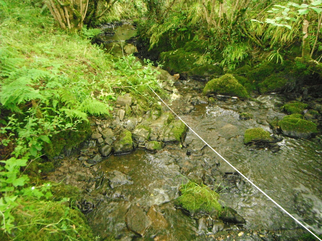
Structural interpretation of ASTER and QuickBird imagery for the Murayjib project area, Saudi Arabia. R/11-02 Processing of Landsat ETM+ imagery for gypsum exploration in the Caxito District, Northwest Angola. R/11-03 Structural interpretation of ASTER and QuickBird imagery for the Wadi Shugea project area, Saudi Arabia. R/11-04 Alteration processing of ASTER data for the Lahuf project, Saudi Arabia. R/11-05 Processing of QuickBird and GeoEye images for four exploration concessions in the Musoma District, Northern Tanzania. R/11-06 Structural interpretation of satellite imagery for the Musoma District, Northern Tanzania. R/11-07 Interpretation of satellite imagery for the northeastern iron ore project area, Northwest Mauritania. R/11-08 Structural interpretation of ASTER imagery for the Huampar District, Peru. R/11-09 Structural interpretation of ASTER and QuickBird imagery for the Rodeo de los Molles project area in San Luis Province, Argentina. R/11-10 Structural interpretation of Landsat ETM+ imagery for the Ting project area and surrounding district, southeast Yukon, Canada. R/11-11 Structural interpretation of ASTER and WorldView-2 imagery for the Fore Burn Igneous Complex, Ayrshire, Scotland. R/11-12 Structural interpretation of Landsat ETM+ imagery for the north of Block 68, northeastern Sudan. R/11-13 Structural interpretation of ASTER and Landsat ETM+ imagery for the Panay project area, Philippines. R/11-14 Structural interpretation of ASTER and WorldView-2 imagery for the Bolostin project areat, Northeastern Mongolia. R/11-15 Structural interpretation of Landsat ETM+ imagery for the Oviedo project area, southeastern Paraguay. R/11-16 Structural interpretation of Landsat ETM+ and ASTER imagery for the Hu’u project area, Sumbawa, Indonesia. R/11-17 Structural interpretation of Landsat ETM+ imagery for part of Block 67, northeastern Sudan. R/10-01 Interpretation of satellite imagery for the Tara Exploration Licences, Co. Meath, Ireland. R/10-02 Interpretation of QuickBird Imagery for the Hamisana Shear Zone and adjacent ultramafic complex, Northeastern Sudan. R/10-03 Processing of Landsat ETM+ imagery for the Hinda Region, Southwest Congo R/10-04 Processing of IKONOS and ASTER imagery for the ASKOT District, Northern India R/10-05 Structural interpretation of merged Landsat+SPOT 5 imagery for the Abelajouad Permit, Arlit District, Northwestern Niger. R/10-06 Structural interpretation of Landsat ETM+ imagery for the Hinda District, Southwest Congo. R/10-07 Refinement of exploration targets using new data for the Montezuma mining area, southern Zimbabwe. R/10-08 Structural interpretation of merged Landsat+SPOT 5 imagery for the Zeline 4 Permit, Arlit District, Northwestern Niger. R/10-09 Structural interpretation of ASTER imagery for the Gambang project area, Northern Luzon, Philippines. R/10-10 Structural interpretation of merged Landsat+SPOT 5 imagery for the Zeline 1 Permit, Arlit District, Northwestern Niger. R/10-11 Structural interpretation of merged Landsat+SPOT 5 imagery for the Assaouas 1 Permit, Arlit District, Northwestern Niger. R/10-12 Structural interpretation of ASTER imagery for the Masbate project area, Philippines. R/10-13 Processing for IKONOS imagery for part of the Hinda permit, Southwest Congo. R/10-14 Structural interpretation of merged Landsat+SPOT 5 imagery for the Assaouas 2 Permit, Arlit District, Northwestern Niger. R/10-15 Structural interpretation of Landsat ETM+ data for the Arlit District, Northwestern Niger. R/10-16 Structural interpretation of Landsat ETM+ imagery for the Chisna project area, south-central Alaska. R/10-17 Structural interpretation of merged Landsat+SPOT imagery for Slieve Dart – Strokestown project area, Galway-Roscommon, Ireland. R/09-01 Structural interpretation of satellite imagery for the Ocampo Mining District, Chihuahua, Mexico. R/09-02 Structural interpretation of Landsat ETM+ imagery for the Aquidawana Licence, Mato Grosso, Southwestern Brazil. On Hold R/09-03 Structural interpretation of Landsat ETM+ imagery for the Gutemberg Licence, Rondonia, Southwestern Brazil. On Hold R/09-04 Structural interpretation of ASTER imagery for the Artvin District, Northeastern Turkey. R/09-05 Provision of IKONOS imagery for two project areas in Northeastern Mauritania. R/09-06 Structural interpretation of satellite imagery for the Ahmeyin-Tijirit Project area, Northern Mauritania. R/09-07 Interpretation of ASTER and QuickBird imagery for the OMM licence areas and surrounding district in the Biga Peninsula, Northwestern Turkey. R/09-08 Interpretation of Landsat ETM+ imagery for the Campestre District,Rio Grande do Sul, Southeastern Brazil. R/09-09 Field structural analysis of Tasiast Gold Mine and surrounding district, Northwestern Mauritania. R/09-10 Provision of IKONOS imagery for two additional project areas in Northeastern Mauritania. R/08-01 Interpretation of ASTER and QuickBird imagery for the Tasiast Gold Project, Northwestern Mauritania. R/08-02 Interpretation of ASTER imagery for Tenement E37/936 and surrounding district, Marshall Creek, Wildara, Western Australia. R/08-03 Interpretation of Landsat ETM+ imagery for the Kasai area in the Democratic Republic of Congo. R/08-04 Interpretation of Landsat ETM+ imagery for the Orotierra Concessions and surrounding district, Southeast Ecuador. R/08-05 Structural interpretation of ASTER imagery for the MV Licences in Northern Mauritania: Final report. R/08-06 Interpretation of satellite imagery for the Phu Bia Contract Area, Northwestern Laos. R/08-07 Interpretation of Landsat ETM+ and ASTER imagery for the Caucasus Region. R/08-08 Structural interpretation of Landsat ETM+ imagery for the Curuguati Licence, Paraguay. R/08-09 Structural interpretation of Landsat ETM+ imagery for the Itacurubi Licence, Paraguay. R/08-10 Interpretation of ASTER imagery for Block EL 28 and surrounding area, Chagai Hills, Western Pakistan. R/08-11 Interpretation of Landsat ETM+ and ASTER imagery for the East Karakoram Region, Northern Pakistan. R/08-12 Regional target generation for the district surrounding the Phu Bia Contract Area, Northwestern Laos. R/08-13 Structural interpretation of Landsat ETM+ imagery for the Sperrins, Northern Ireland. R/08-14 Structural interpretation of satellite imagery for the Collahuasi District, Northern Chile. R/07-01 Structural interpretation of ASTER imagery for the MV Licences in Northern Mauritania: Preliminary report. R/07-02 Structural interpretation of QuickBird imagery for the Eikwan Prospect, NE Sudan. R/07-03 Structural interpretation of Landsat ETM+ imagery for the Montezuma mining area, southern Zimbabwe. R/07-04 Structural interpretation of Landsat ETM+ imagery for the Ucua Licence, Angola. R/07-05 Structural interpretation of Landsat ETM+ imagery for three Coal Bed Methane project areas, western Zimbabwe. R/07-06 Structural interpretation of Landsat ETM+ imagery for the Ruenya area, eastern Zimbabwe. R/07-07 Structural interpretation of ASTER imagery for an area in the Precordillera Range, Northwestern Argentina. R/07-08 Interpretation of ASTER and QuickBird imagery for the Nimu project area, Xizang Province, Southern Tibet. R/07-09 Interpretation of ASTER and QuickBird imagery for the Mohave Project Area, Northwest Arizona, USA. R/07-11 Structural interpretation of ASTER imagery for the Diamante-Los Patos exploration project and surrounding district, Northwest Argentina. R/07-12 Structural interpretation of ASTER imagery for the Bororo Nuevo exploration project and surrounding district, Chubut Province, Argentina. |
|
2002-2006
R/06-01
Structural interpretation of Landsat ETM+ imagery for the Lovua Licence, Angola. R/06-02 Structural interpretation of Landsat ETM+ imagery for the Quitapa Licence, Angola. R/06-03 Structural interpretation of QuickBird imagery for the Orshab Prospect, NE Sudan. R/06-04 Structural interpretation of Landsat ETM+ imagery for the Cachoeiras de Binga District, western Angola. R/06-05 Structural interpretation of ASTER imagery for the Pinaya District, southern Peru. R/06-06 Structural field analysis of Gumushane District and Copler District, Eastern Turkey. R/06-07 Structural interpretation of Landsat ETM+ imagery for the Bohaun Gold Project, Connemara, Ireland. R/06-08 Structural analysis of the Central Anatolian Block, Turkey. R/06-09 Structural interpretation of Landsat ETM+ imagery for the Lough Gowna Gold Project, Co. Longford, Ireland. R/06-10 Summary report on fieldwork in the western part of the Central Anatolian Belt. R/06-11 Structural study of Rozalia Mine, Stiavnica-Hodrusa District, Slovakia. R/06-12 Structural interpretation of QuickBird imagery for the Aberkateib Prospect, NE Sudan. R/06-13 Structural interpretation of QuickBird imagery for the Blandalawateib Prospect, NE Sudan. R/05-01 Structural interpretation of ASTER imagery for Las Sorpresas Property and Yanacocha District, NW Peru. R/05-02 Structural interpretation of ASTER imagery for the Murat Dag District, western Turkey. R/05-03 Interpretation of ASTER imagery for the Salamanca area, Spain. R/05-04 Interpretation of Landsat ETM+ imagery for the East Safawi Block, Jordan. R/05-05 Structural interpretation of satellite imagery for the Tunceli District, eastern Turkey. R/05-06 Structural field analysis of the Salamanca Gold Project, Western Spain. R/05-07 Structural interpretation of ASTER imagery for Casposo District, western San Juan Province, Argentina. R/05-08 Structural study of La Cienega Mine and District, Durango, Mexico. R/05-09 Structural interpretation of satellite imagery for the Longonjo-Kuvo-Huabi Project, Angola. R/05-10 Structural interpretation of Landsat ETM+ imagery for the Chipindo Licence, Angola. R/04-01 Interpretation of ASTER imagery for the Lahoca District, northern Hungary. R/04-02 Structural interpretation of ASTER imagery for the Nador-Melilla district, northern Morocco. R/04-03 Structural interpretation of Landsat ETM+ imagery for the Tracia Region, NW Spain. R/04-04 Structural interpretation of Landsat ETM+ imagery for western and NE Ghana. R/04-05 Structural study of the Dawa Digati Gold Project, Adola Belt, southern Ethiopia. R/04-06 Preliminary notes on the structural interpretation of Landsat ETM+ imagery for the Cañariaco Property, NW Peru. R/04-07 Interpretation of Landsat ETM+ and ASTER imagery for south-central Macedonia. R/04-08 Interpretation of Landsat ETM+ imagery for the southern Burgas District, Bulgaria. R/04-09 Interpretation of ASTER imagery for the San Luis area, Chanaral Province, Chile. R/04-10 Structural interpretation of Landsat ETM+ Scene No. 179/33, west-central Turkey. R/04-11 Structural interpretation of Landsat ETM+ Scene No. 174/32 for NE Turkey. R/04-12 Structural interpretation of Landsat ETM+ imagery for Cañariaco Property, NW Peru. R/04-13 Notes on the ASTER derived high sulphidation alteration anomalies for the San Luis area, Chanaral Province, Chile. R/04-14 Interpretation of ASTER imagery for the Kremnica District, Central Slovakia. R/04-15 Structural interpretation of Landsat ETM+ imagery for Aberkateib Block, NE Sudan. R/03-01 Interpretation of aerial photographs and Landsat ETM+ imagery for SE Ecuador. R/03-02 Structural interpretation of Landsat ETM+ imagery for the eastern Lake Victoria Region, East Africa. R/03-03 Structural interpretation of Landsat ETM+ imagery for the Salamon area, NW Spain. R/03-04 Structural interpretation of Landsat ETM+ imagery for the Curraghinalt District, Co. Tyrone, Northern Ireland. R/03-05 Structural interpretation of satellite imagery for the Alto Dorado-Toril District, Peru. R/03-06 Comments on the structure of the Poyatus-Lomero District, Iberian Pyrite Belt, Spain. R/03-07 Structural interpretation of ASTER imagery for the Tracia District, Galicia, NW Spain. R/03-08 Interpretation of aerial photographs, Landsat ETM+ and Radarsat imagery for an area in Central Kalimantan. R/03-09 Structural interpretation of Landsat ETM+ imagery for Western Desert Region, Iraq. R/02-01 Preliminary report on the structural interpretation of Landsat ETM+ imagery for North-Central Newfoundland. R/02-02 Structural interpretation of ASTER imagery for the Tamlalt area, eastern Morocco. R/02-03 Final report on the structural interpretation of Landsat ETM+ imagery for North-Central Newfoundland. R/02-04 Field structural analysis of the Jebel Malek Prospect, eastern Morocco. R/02-05 Processing and interpretation of ASTER imagery for the SE Rhodopes, Bulgaria. |
